Zoning is one of the most influential tools local governments use to shape how communities grow, yet it’s also one of the least understood. In a county as dynamic as Union County—with 14 municipalities, a strong agricultural heritage, and continued residential growth—zoning plays a central role in determining where homes, farms, businesses, and industries can locate. While each municipality has its own zoning ordinance, the basic principles are consistent across North Carolina.
This article offers a simple, accessible explanation of how zoning works and why it matters for residents, businesses, and the long-term health of the community.
What Zoning Is and Why It Exists
At its most basic level, zoning answers three fundamental questions for every property:
- • What can be built here?
- • How should it be built?
- • What is the long-term vision for this area?
These questions help communities guide growth in a thoughtful and predictable way. Zoning separates incompatible land uses, ensures development standards are met, and helps preserve the character and function of different areas, whether rural farmland, residential neighborhoods, commercial corridors, or industrial job centers.
In North Carolina, zoning decisions must align with a community’s officially adopted land-use plans. This keeps development tied to long-term goals rather than short-term pressures.
Zoning in a County With 14 Municipalities
Union County’s structure adds a layer of complexity: zoning authority is shared across 14 municipalities plus the County government. If a property is inside a town’s limits, the town determines the zoning. Some municipalities also use Extraterritorial Jurisdiction areas (ETJs), which are small areas just outside their borders where towns may apply their zoning regulations. Not every municipality chooses to exercise ETJ authority, but where ETJs do exist, they help ensure that development near a town’s boundary aligns with long-range plans.
If a property lies in an unincorporated area outside any town limits or ETJ, Union County manages the zoning. While the zoning district names differ slightly from place to place, the categories are similar enough that a general explanation can help residents make sense of most terms they encounter. As opposed to detailing the rules of all 14 jurisdictions in one place, this blog focuses on general North Carolina zoning patterns that apply broadly across Union County.
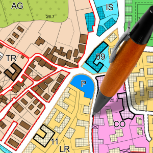
Common Zoning Districts You Might Hear About
Although every municipality in Union County uses its own zoning map, many follow similar patterns, particularly in how they structure residential and agricultural districts. The following descriptions reflect zoning categories commonly found across Union County and in the County’s Unified Development Ordinance (UDO) for unincorporated areas.
Residential Districts
- • RA-40 (Residential–Agricultural, 40,000 sq ft minimum lots)
A low-density residential district that often blends rural living with limited residential development. These areas typically allow single-family homes on larger lots and sometimes include agricultural uses. - • R-40 (Single-Family Residential, 40,000 sq ft minimum lots)
A low-density residential district similar to RA-40 but generally more focused on traditional residential development rather than agricultural compatibility. - • R-20 (Single-Family Residential, 20,000 sq ft minimum lots)
A medium-density residential district commonly found in growing suburban areas. R-20 lots are smaller than R-40 lots, but the area remains primarily single-family in character. - • R-15 (Single-Family Residential, 15,000 sq ft minimum lots)
A higher-density single-family district that allows smaller lots. In some jurisdictions, this district may begin to introduce more housing variety, depending on local ordinances.
Agricultural Districts
- • AG/Agricultural (sometimes labeled “Agricultural Conservation” or “Rural Agricultural”)
Designed to preserve farmland and support agricultural operations. These districts allow farming, limited residential development, and land uses that complement the county’s agricultural economy.
Commercial Districts
(These vary more widely across the 14 municipalities, but the following are common patterns.)
- • C-U / General Commercial or Highway Commercial
Areas intended for retail, restaurants, offices, and other services that support residents and visitors. They often appear along major roads or in community commercial centers. - • Neighborhood Commercial (various labels such as C-N, B-1, or C-1)
Small-scale shops and services intended to serve nearby neighborhoods, typically with lower traffic intensity.
Industrial Districts
- • LI (Light Industrial)
Allows warehousing, distribution, small-scale manufacturing, and logistics. These districts typically include buffering requirements when located near residential areas. - • HI (Heavy Industrial)
Intended for more intensive manufacturing and industrial operations. These districts are usually located near major transportation routes and away from residential neighborhoods.
How Zoning Supports Union County’s Growth and Character
Zoning shapes not only where development occurs but also how a community balances growth with preservation. In a county with a thriving agricultural sector and a high demand for housing, zoning helps maintain rural landscapes while guiding new development toward areas that can best support it.
Zoning also influences the availability of locations for businesses and future employers. Areas designated for commercial or industrial use help create jobs, expand the local tax base, and support economic diversification. When communities have a mix of residential, agricultural, and business districts, it strengthens long-term economic stability.
Another important aspect of zoning is its connection to public infrastructure. While each jurisdiction makes its own zoning decisions, planning for roads, utilities, water, and wastewater capacity is closely intertwined with land-use decisions. These considerations require ongoing coordination and collaboration across county and municipal boundaries to support the needs of residents, businesses, and future growth.
How Zoning Decisions Are Made in North Carolina
Although every jurisdiction has its own process, most follow this framework:
- A property owner or developer submits a rezoning or land-use request.
- Planning staff review it for consistency with adopted land-use plans.
- The Planning Board reviews the request and issues a recommendation.
- Elected leaders hold a public hearing where residents may offer input.
- The Town Council or County Commissioners make the final decision.
This process ensures that zoning changes are thoughtful, public, and connected to a long-term vision.
Why Understanding Zoning Matters
A basic understanding of zoning helps residents and businesses make sense of why certain types of development occur in specific places, how farmland is preserved, where future economic opportunities may be located, and how long-term infrastructure planning happens. Zoning does not determine every outcome, but it provides the framework that guides how Union County evolves over time. For a community that values both its rural roots and its economic future, zoning is one of the key tools that helps balance those priorities.
Last modified: February 5, 2026